
PRELIMINARY DETERMINATION (PD)
The first step in obtaining a commercial aquaculture lease is the preliminary determination process.
The preliminary determination process is designed to give the government agencies that regulate aquaculture, town officials (harbor committee, harbor master, planning department, etc.), RI Department of Environmental Management and the applicant a chance to review and discuss the proposal. This meeting usually occurs in the town offices adjacent to the proposed site (or virtually) and may include representatives from the U.S. Army Corps of Engineers, National Marine Fisheries Service, environmental organizations, commercial and recreational fishing industry associations, the town residents, and CRMC. At this meeting the proposed aquaculture lease will be discussed and the applicant will be expected to answer any questions that arise.
After the meeting the CRMC Aquaculture Coordinator will prepare a report to the applicant detailing suggestions and/or recommendations that arise from the meeting. The applicant does not have to take these suggestions into account when preparing the full application. However, the applicant must be aware that these suggestions and/or recommendations will surface again during the application process and the choice of not heeding them will have to be defended. Once the applicant has received the PD report they can apply for an aquaculture lease from the CRMC.

PRELIMINARY DETERMINATION REQUEST FORM
All of the following required application documents must be organized into four (4) assembled packet when submitted to be considered a complete application.
APPLICATION FEE: $25.00
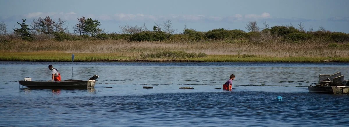
PHOTOS of the project site and adjacent area: (minimum size 3" x 5" maximum size 8"x 10")
COMPLETED APPLICATION FORM : The application form needs to be complete and concise and the description must completely outline all the work proposed on the submitted site plans. This concise written description is essential in order to put the project out to public notice and expedite the processing of the application.
LOCATION MAP: Use a NOAA nautical chart to accurately delineate the site location. The location map must include a map scale, a north arrow and an accurate latitude-longitude coordinates for the site (please go out 6 decimal places). The map should be no smaller than 8½” by 11”. Google maps are acceptable.
SITE PLANS: All plans must include applicant’s name, date of preparation, scale and north arrow (indicate magnetic or true north). Complete site boundary lines must be shown on the plan view. All corners of the site must be accurately delineated in latitude-longitude coordinates and shown on the plans. Be sure to include appropriate scale and distance from the site to the nearest shoreline.
The PROPOSED GEAR LAYOUT must be shown on the PLAN VIEW. Depth contours must also be shown on this site plan view for the proposed lease area at mean low tide. Be sure to show all of the proposed gear (cages, racks, netting, etc.) within the site. A separate sheet depicting a typical cross section view (from deepest to shallowest portions) of the entire site at the same scale as the plan view which includes the gear layout. Mean high and mean low tide elevations must be indicated on the cross section view plan. Detailed drawings of the proposed gear (cages, racks, nets, etc.) showing typical dimensions must be provided on an 8½" by 11" sheet. Applicant must show depth of water covering the gear at mean low tide for the shallowest portion of the site. Reduced site plans on an 8½" x 11" sheet must be provided if the original site plans are on larger sheets.
ATTENTION: Upon receiving written verification of application acceptance by the CRMC, you will be required to mark the four corners of the proposed aquaculture site with standard 11 inch pot buoys. Each buoy must have the following notation in 3 inch letters “CRMC” and the file number given to you at the time of notification. You must complete this requirement within 10 days of receiving the CRMC written notification in order to assist the CRMC staff in evaluating your proposed aquaculture site.
OPERATIONAL PLAN - See the 2019 Guidance Document This Microsoft Word document is intended to be used by licensees/operators as a template when preparing plans and may be modified as needed to fit the specific needs of the operator.
Written requirements of Rhode Island Coastal Resources Management Program (RICRMP):
PROVIDE WRITTEN RESPONSE to all items in Section 1.3.1(A)
(1) demonstrate the need for the proposed activity or alteration;
(2) demonstrate that all applicable local zoning ordinances, building codes, flood hazard standards, and all safety codes, fire codes, and environmental requirements have or will be met; local approvals are required for activities as specifically prescribed for nontidal portions of a project in Sections 1.3.1(B), 1.3.1(C), 1.3.1(F), 1.3.1(H), 1.3.1(I), 1.3.1(K), 1.3.1(M), 1.3.1(O) and 1.3.1(Q); for projects on state land, the state building official, for the purposes of this section, is the building official;
(3) describe the boundaries of the coastal waters and land areas that are anticipated to be affected;
(4) demonstrate that the alteration or activity will not result in significant impacts on erosion and/or deposition processes along the shore and in tidal waters;
(5) demonstrate that the alteration or activity will not result in significant impacts on the abundance and diversity of plant and animal life;
(6) demonstrate that the alteration will not unreasonably interfere with, impair, or significantly impact existing public access to, or use of, tidal waters and/or the shore;
(7) demonstrate that the alteration will not result in significant impacts to water circulation, flushing, turbidity, and sedimentation;
(8) demonstrate that there will be no significant deterioration in the quality of the water in the immediate vicinity as defined by DEM;
(9) demonstrate that the alteration or activity will not result in significant impacts to areas of historic and archaeological significance;
(10) demonstrate that the alteration or activity will not result in significant conflicts with water-dependent uses and activities such as recreational boating, fishing, swimming, navigation, and commerce, and;
(11) demonstrate that measures have been taken to minimize any adverse scenic impact (see Section 1.3.5).
REVIEW SECTIONS 1.1.10 and 1.3.1(K) of the RICRMP.
Information regarding provisions for pedestrian access to the shore and availability of lease area for other uses, including but not limited to, boating, swimming, fishing, etc.
Note: All proposals are forwarded to the Rhode Island Historical Preservation & Heritage Commission for review and comment in accordance with Section 1.2.3 of the RICRMP. In some cases, the applicant may be required to submit the results of an archaeological assessment survey in order to document the presence or absence of significant archaeological sites. If the proposed development would damage a significant historical or archaeological resource, the Council may require modification of, or prohibit the proposed action.